Please click here for the updated version of this post
This Post covers
- Coverage Area of Postcode TS20 to TS29
- Total Sales By Postcode TS20 to TS29 in 2016
- Average & Median Sales Price By Postcode TS20 to TS29 in 2016
- Spread of Sales Price By Postcode TS20 to TS29 in 2016
- Total Number of Sales By Postcode TS20 to TS29 in 2016
- Property Posts for Postcode Area TS
- Schools for Postcode Area TS
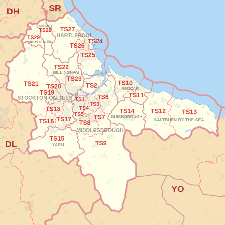
Coverage Area of Postcode TS20 to TS29
|
|
| Postcode |
Coverage Area |
Local Authority Area |
| TS20 |
Norton, Mount Pleasant |
Stockton-on-Tees |
| TS21 |
Stillington, Bishopton, Redmarshall, Thorpe Thewles, Carlton, Sedgefield, Long Newton |
Stockton-on-Tees |
| TS22 |
Billingham (West), Wolviston |
Stockton-on-Tees |
| TS23 |
Billingham (East) |
Stockton-on-Tees |
| TS24 |
Hartlepool town centre, Hartlepool Marina, Stranton, Belle Vue, Headland |
Hartlepool |
| TS25 |
Seaton Carew, Fens Estate, Owton Manor, Rift House, Greatham |
Hartlepool |
| TS26 |
Middle Warren, Upper Warren, Bishop Cuthbert, Throston, West Park |
Hartlepool |
| TS27 |
Blackhall Rocks, Blackhall Colliery, Castle Eden, Hesleden, High Hesleden, Hutton Henry |
Hartlepool, County Durham |
| TS28 |
Wingate, Station Town |
County Durham |
| TS29 |
Trimdon |
County Durham |
Total Sales By Postcode in 2016

*M represents Million Pounds
Average & Median Sales Price By Postcode in 2016


*Average and Median Sales Price are in Pounds
Spread of Sales Price By Postcode in 2016

*STDEV is Standard Deviation
For example,
- Say the average detached property price for postcode XYZ is £300 K and ST. DEV. is 30 K.
- It means that most detached properties in postcode XYZ (about 68%) has price within one ST. Dev. i.e. the price range is £270K - £330K.
- All-most all detached property price (95%) in postcode XYZ lie between two ST. Dev. i.e. £240 K - £360 K
Total Number Of Sales By Postcode in 2016

Property Posts for Postcode Area TS
Schools for Postcode Area TS
- TS Postcode Area - TS1, TS2, TS3, TS4, TS5, TS6, TS7, TS8, TS9 School Details
- TS Postcode Area - TS10, TS11, TS12, TS13, TS14, TS15, TS16, TS17, TS18, TS19 School Details
- TS Postcode Area - TS20, TS21, TS22, TS23, TS24, TS25, TS26, TS27, TS28, TS29 School Details
North East England Postcode Area Posts

Reference
NE Postcode Area As Per Wikipedia
0aa2c111-f00e-406f-adeb-b7dca1b31907|0|.0|27604f05-86ad-47ef-9e05-950bb762570c